From County to Polling Station: Walking Kenya's Geography on the Platform
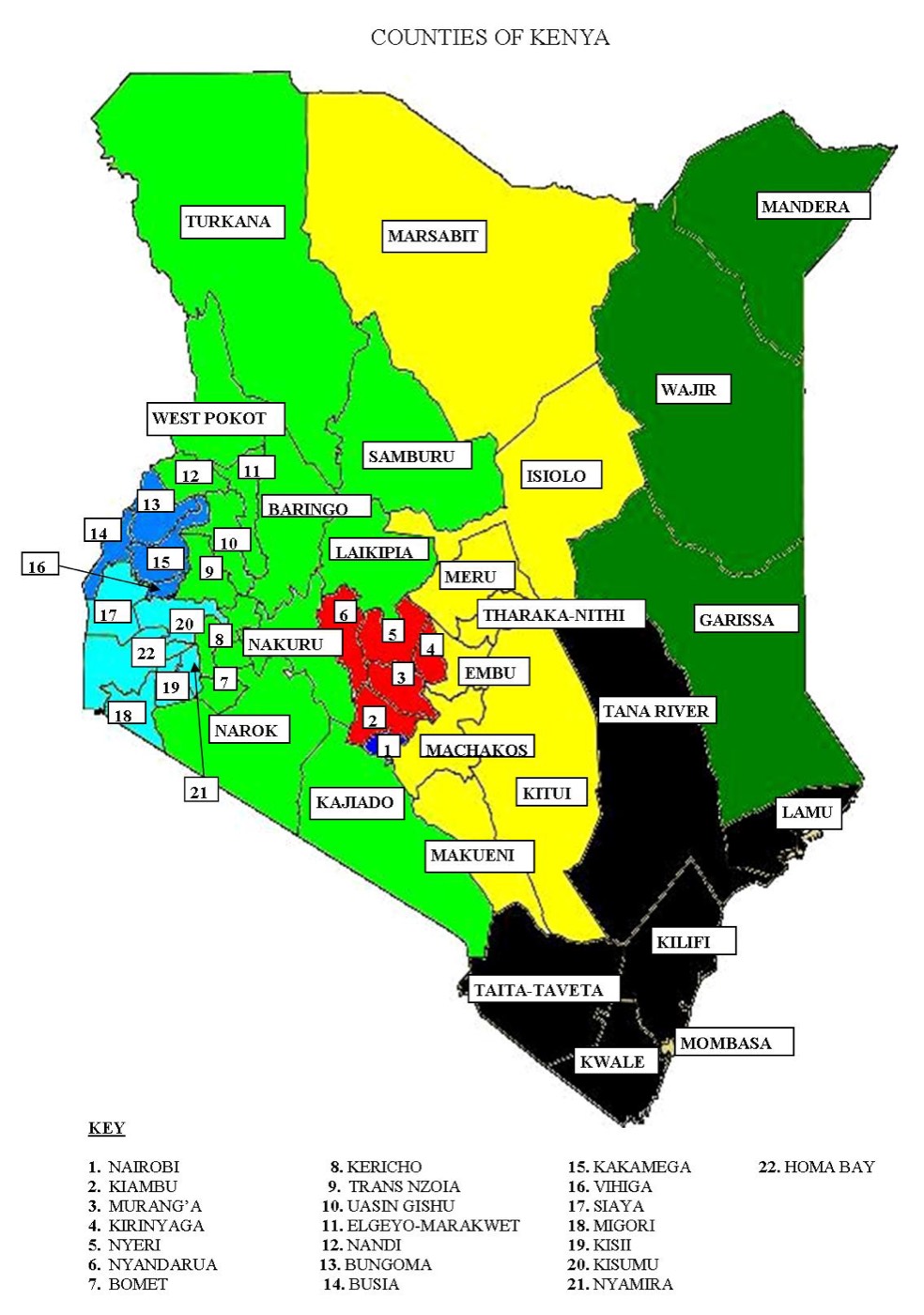
Ask a campaign where its votes are and you will get the name of a county.
Ask where the work happens and the honest answer is a polling station: one room, one presiding officer, one queue, one set of forms at the end of the day. Everything above that level is a way of adding stations together.
The geography explorer on the platform goes all the way down, and it is public.
Five levels, and the last one is the one that counts
Kenya, then county, then constituency, then ward, then the polling centre and the polling stations inside it.
Each level is its own page and each page is a link. Drilling from Kenya into a county into a ward does not throw away where you have been, and the address bar carries the code of whatever you are looking at rather than a long internal identifier. That is deliberate. A link to a ward page should survive being pasted into a group chat, and a code is legible in a way a random string is not.
The structure is fixed by law and by boundary review, not by us. Each county elects one Governor, one Senator and one Woman Representative. Each of the 290 constituencies elects one MP. Each of the 1,450 wards elects one MCA. Everything the platform does with geography inherits that shape.
What sits on a county or ward page
The register, the census, the map, and who the place elected.
The register figures tell you how many voters the area carries. The census figures give you the population behind them, which is a different number and a more useful one when you are working out how many people in a ward are eligible but not registered. The map draws the actual boundary, which matters more than people expect, because a great many arguments about campaign territory are really arguments about where a line runs.
Underneath, the list of what the place contains: the constituencies in a county, the wards in a constituency, the polling centres in a ward.
Why the polling station is the unit of work
Because every operational question a campaign has resolves to a station.
Where does the agent sit. Which stream is uncovered. Where did the queue move slowly. Which centre is a forty-minute walk from the nearest matatu stage and therefore needs its agent to sleep nearby the night before. Those are station questions, and a campaign that plans at ward level and improvises at station level is a campaign that discovers the gaps on the morning of the vote.
This is why agent deployment on the platform is built on the station list rather than on a ward count. That is covered in assigning agents and reading the gaps.
When the data for your area looks wrong
Sometimes it will be, and you should say so.
Polling station data in Kenya is not tidy. Names change, centres split, codes get transcribed, and a station that exists on paper can turn out to be a tent in a field. The platform imports what the published sources carry and repairs what it can identify as broken, but a person who lives in the ward knows things no file contains.
The useful check is simple. Open your ward, read the list of centres and stations, and see whether the places you know are all there under names you recognise. If a centre is missing or a name is wrong, that is a finding worth reporting in 2026 while there is time to fix it, rather than in the last week before the vote when nobody can.
What campaigns should do with this in 2026
Print nothing yet. Read first.
Open your ward and count the polling centres. Then count the stations inside them, because a centre with four stations needs four agents and a campaign that budgeted per centre has just underfunded itself by a factor it can still fix.
Then compare the register figure with the census figure for the same ward. The difference is your unregistered population, and voter registration is the only campaign activity that adds voters rather than moving them. A ward coordinator's weekly work follows from that comparison more directly than from any rally: see what a ward coordinator should be measured on.
Then write the station list down, with names, and keep it. Everything else the campaign does in the next twelve months attaches to that list.
Frequently Asked Questions
What is the difference between a polling centre and a polling station?
A polling centre is the place, usually a school or a social hall. A polling station is a voting point inside it, each with its own presiding officer, its own register segment and its own set of result forms. One centre commonly holds several stations, which is why a campaign that counts centres rather than stations always under-recruits agents.
Can I find my polling station without signing in?
Yes. The geography explorer is public at every level, from the national view down to individual polling stations. Signing in is only needed for campaign work such as assigning agents or managing volunteers, because those actions create records that must be attributable to somebody.
Does the platform decide where polling stations are?
No. The IEBC gazettes polling centres and stations, and boundaries are set through delimitation under the Constitution. The platform imports and displays what the published sources contain. Where our copy of that data is wrong or out of date, the fix is a correction to our import, not a change to anything official.